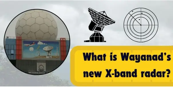
In July 2024 Wayanad district of Kerala was struck by floods and landslides that claimed
more than 200 lives. In response, the Union Ministry of Earth Sciences has given its nod to
install X-band radar in the district for better monitoring of weather conditions and warning.
What is an X-Band Radar?
An X band radar functions in somewhere in the extreme high frequency range of 8-12 GHz in
the electromagnetic spectrum with 2-4 cm wave lengths. This radar is best suited to
identifying small particles such as rain, fog and other similar materials owing to its short
wave length that provides high resolution detail images.
X-Band Radar: The Main Characteristics of Wayanad
High Resolution and Accuracy
The radar that has been installed at Wayanad is the X-band radar, which is considered to
have a very high resolution in addition to being highly accurate. Working at the frequency
band of 8-12 GHz with the wavelengths of 2-4 cm, the radar is good at perceiving small
objects such as rain droplets and fog. The higher frequencies are produced by the shorter
wavelengths which are essential in providing accurate images through weather/geo-physical
system-tracking and distinguishing between possible landslides or other disasters. This high
resolution enables the radar to deliver data at the right time which helps in preparing for, or
responding to disasters.
High Temporal Sampling
It is noteworthy that the radar, operating in the X band, provides a significant potential for
performing a high temporal sampling. This means that the radar can capture and quantify
change in environment state at high frequency. Obviously, any capability of this nature could
be more desirable in a place like Wayanad which experiences frequent changes in weather
and is often associated with regular cases of landslides. High temporal sampling makes it
possible to monitor the progress of climatic conditions and access information that can help
authorities provide timely warnings and prevent the effects of natural disasters.
Versatility in Applications
The main operational use of the X-band radar located in Wayanad is meteorological
observation and analysis, as well as for disaster management, but it useful for other fields as
well. They are used in mountainous terrain area, aviation and military operations specifically
X-band radars. In aviation the radar plays a vital role in identifying the weather features,
turbulence and thus makes flying safer. In military operations, it is employed in surveillance
and reconnaissance, to obtain detailed photographic and other information for tactical
purpose. X-band radar is useful in various domains due to its flexibility of use.
Strong data analysis functions
By processed user’s data and subsequent limiting results the X-band radar is supplied with
powerful means to analyse general radar data. In disaster management where a great deal of
information is collected, this feature provides an efficient and comprehensive way of
analysing it. The radar’s information-processing function helps the authorities think
critically and respond promptly to various emergencies. Thus, the use of detailed and rather
accurate information from the X-band radar improves the efficacy of the actions undertaken
in disaster predisposing conditions.
Future Prospects
The success achieved by the X-band radar at Wayanad can facilitate the installation of other
such radars in other sensitive areas in the country. This would go along way in enhancing the
countries disaster management response and enhance safety in general. It is expected that as
advancement in the technology grows, more enhancements will be made to X-band radars,
providing more accurate data collection as well as timely data in the early preparation and
during disaster occurrence.
The Roles and Significance of X-Band Radar for Wayanad
Wayanad is in the Western Ghats of the nascent state of Kerala: it is like a planted spot,
surrounded with vegetation and different colours of nature. Nevertheless, it is also capable of
experiencing natural disasters such as heavy rain, floods, landslide in case of an early rainy
season. Consequently, frequent and powerful occurrences explain why placing an X-band
radar in Wayanad would be contributing to the region’s improvements in disaster readiness
and progress in meteorology.
Enhancing Weather Monitoring
X–band radar in the frequency range of 8-12 GHz has exceptional resolution data essential
for proper weather forecasting. Its capacity to measure particles of such small size as rain
drops and fog guaranties that even minimal changes of weather conditions can be observed.
This added monitoring ability enables the meteorologists to monitor the climate changes in
more detail hence enabling accurate and timeous weather forecasts. Such precision is all the
more needed for a region like Wayanad which can be devastated by a change in weather in
the wink of an eye.
Alarm System and Disaster Prevention
Other advantage of the X-band radar that will be situated at Wayanad is that it gives early
warning of natural calamities. Having the radar scan the weather conditions and regular
movements of the soil, it is possible to predict landslides and floods much earlier. This is a
very useful in the provision of timely warning to the residents of the area, on what action to
take in order to protect their lives and properties from the perceived or known disasters or
hazards. Hence in a region prone to such disasters, early warning systems go a long way in
minimizing on the effects to the lives.
Real Time Data to Provide a Decision Support System
Due to the nature of the X-band radar that allows real-time data, the proper decision can be
made in case of an emergency. The radar’s temporal resolution is high compared to other
sensors, it is therefore capable of acquiring current data to the environment rapidly. That
real-time information is very important for the disaster management groups to get the full
clear picture on the status of disaster and to allocate the needed resource.
Supporting environmental and agricultural studies
In addition to disaster management the X-band radar portrays a unique role in
environmental and agricultural research. Weather information is important in mapping and
analysing climatic conditions, rainfall distribution and soil water conditions. From this
information sustainable farming methods, irrigation calendars, and improved crop yields
can be obtained. In this case therefore, similar data may help farmers in Wayanad to
increase production of crops as well as tolerance to fluctuating climate.
Enhancing the Resilience of Infrastructure
The information collected by the X-band radar can also be information to enhance the
systems in the region especially in Wayanad. In addition to that, when the authorities
consider the weather patterns, then try and search for the weak areas, it becomes easier to
develop structures that can accommodate infrastructure that does not collapse in natural
disasters. Concerning both the creation of highly flood-resistant buildings and on
redesigning or clogging systems to prevent floods, the radar could provide some useful
information for advancing this end.
Challenges
Initial Costs and Maintenance
X-band radar for installation requires substantial capital layout in the initial stages. Such
costs are for buying the radar, transporting it to its installation site and establishing the
necessary facilities for the radar. However, it cannot be said that the radar is left to work on
its own; proper maintenance is also vital for the effective workings of the radar. Maintenance
requires the professional approach, that means time and effort have to be spent constantly,
both of which can additionally affect financial resources.
Technical Expertise
The operation of an X-band radar falls with operators who possess certain level of skills and
knowledge. Technical professionals must be required to operate the complex tools, work with
accurate results of the data collected and perform repair work. Such specialist staffs are
probably difficult to train and retain let alone placing them in remote areas such as
Wayanad.
System Integration to Existing Systems
One of the challenges of including the X-band radar to the existing weather observation and
disaster management networks is therefore the compatibility issue. It calls for integration of
data and passing on of data across various organizations. There is a need to implement
sound integration and collaboration mechanisms so that radar data is incorporated
efficiently into decision-making systems.
Data Management and Interpretation
There is a need to design and implement a reliable means to process, store and analyse the
large amounts of data produced by the X-band radar. This is usually achieved under
enhanced data management systems and use of analytical tools. Failure or, at best,
misunderstanding and slow action resulting from the data can lead to wrong weather
predictions and inefficient response to disasters.
Environmental Factors
Complications may arise due to Wayanad location or climatic conditions that may affect the
radar functioning. Excessive humidity, high rainfall intensity or rate and growth of
vegetation at the site may cause problems to radar’s functionality and quality of data
collected. Maintaining radar in such a way that it will work properly during such fogs
demands so much effort and a constant check on it.
Community Engagement
Disaster preparedness requires the radar to provide its benefits to the local community and
its members to know how to confirm to the warning system. In turn, this requires a vast
amount of efforts invested into community outreach and development intervention. The
combination of skepticism and seeking community cooperation can be quite of a task.
Funding and Sustainability
However, the greatest challenge may be acquiring the capital to finance the radar’s initial
construction and subsequent use. It’s for this reason that sustainability is highly desirable in
that it makes it possible to achieve effective operation of the radar in the longer term. These
entail future considerations such as upgrading it in the future, the cost of maintain this fence
and in the future inclusiveness of expanding it to touch other vulnerable areas.
Way Forward
1. Securing Adequate Funding
- Government Grants and Subsidies: Requesting funds from Headquarters and Grants and Subsidies Funds which are targeted at increasing the Disaster Preparedness and Weather Observation Systems.
- Private Sector Partnerships: Working with companies and organizations of the private sector that have stake in disaster management and environmental conservation.
- International Aid and Funding: Formulating loans from the international lender such as the World Bank, UNDP, and other global bodies in DRR and climate change.
2. Building Technical Expertise
- Training Programs: Ensuring the implementation of intensive training solutions to the local employees to address the installation, use and effective functional of the X-band radar.
- Workshops and Seminars: Conducting meetings and discussions with professionals in meteorology, radar system, and disaster response in order to increase everyone’s awareness.
- Technical Collaborations: Collaborating with academic and research institutions to deliver customized radar courses and certifications to advanced meteorology.
3. Ensuring Seamless Integration
- Data Integration Platforms: To enhance the systems of data integration that improves, the radar data sharing, analysis among the various agencies and departments.
- Standardized Protocols: To maintain the quality of data collected, interpreted, and reported when observing or predicting weather elements or reacting to disasters, set out common procedures to be followed.
- Regular Coordination Meetings: Organising of different stakeholders’ coordination meetings that are meant to address the issues faced, update of information and mapping of processes.
4. Enhanced data management as well as its interpretation
- Advanced Analytics Tools: X-band radar produces enormous amounts of information, and using sophisticated applications for data analysis and using numerical models.
- Continuous Monitoring: Some policy implications include: Continuing to conduct vigilance surveys with a view of maintaining efficient and effective data collection by the radar as well as doing away with compromised data quality.
5. Environmental factors and its relation to change
- Weather-Resilient Infrastructure: Protecting the weather monitoring and tracking radar system used the X-band radar through developing structures capable of withstanding adverse weather conditions.
- Environmental Impact Assessments: Urging scientific consequences evaluating geographical and climatic conditions that could presume interfering with radar and making corrections if needed.