UPSC Current Affairs
NATIONAL HIGHWAY GREEN COVER INDEX REPORT
National Highways Authority of India released the first Annual Report on the National Highways Green Cover Index (NH-GCI). The report measures how much green cover (plants and trees) exists along India’s national highways. It was prepared with help from National Remote Sensing Centre, which works under Indian Space Research Organisation.
VRAuthor Desk
3 min read
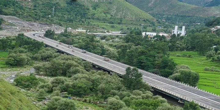
National Highways Authority of India released the first Annual Report on the National Highways Green Cover Index (NH-GCI). The report measures how much green cover (plants and trees) exists along India’s national highways. It was prepared with help from National Remote Sensing Centre, which works under Indian Space Research Organisation.
Why this news?
- National Highways Authority of India released the first Annual Report on the National Highways Green Cover Index (NH-GCI).
- The report measures how much green cover (plants and trees) exists along India’s national highways.
- It was prepared with help from National Remote Sensing Centre, which works under Indian Space Research Organisation.
WHAT IS NH GCI?
- National Highways Green Cover Index (NH-GCI) is a system used to measure the amount of vegetation along National Highways.
- Purpose
- To check how green the highways are.
- To track tree plantation and greenery along roads.
- To support environment-friendly highway development.
- In simple words, it tells how much area near highways is covered with plants and trees.
HOW THE GREEN COVER IS MEASURED?
- The measurement uses satellite technology.
Method
- Satellites detect chlorophyll in plants.
- Chlorophyll is the green pigment in leaves that helps plants do photosynthesis.
Using satellite sensors:
- Scientists detect the presence of vegetation.
- They calculate how much of the land has greenery.
The result is shown as a
percentage value.
Example
- If NH-GCI = 40%, it means 40% of land along that highway area has green cover.
AREA COVERED IN THE FIRST REPORT
- In the first assessment:
- Around 30,000 km of National Highways were studied.
- The highways were located in 24 states of India.
- The data covers the period July–December 2024.
- Future reports will be released every year to track improvements in greenery.
WHAT IS RIGHT OF WAY?
- The index measures greenery within the Right of Way (RoW) of highways.
Right of Way (RoW) means:
- The official land area reserved for a highway.
- It includes:
- Road lanes
- Roadside land
- Space for utilities and plantations.
NH-GCI measures
green cover on both sides of the highway within this area.
ROLE OF SPACE TECH
- The study uses advanced satellite-based monitoring.
- Benefits of this approach:
- Scientific and accurate measurement
- Large area coverage
- Cost-effective
- Time efficient
- Instead of manual surveys, satellites can quickly analyse thousands of kilometres of highways.
INSTITUTIONAL COOPERATION
- The initiative is based on a 3-year Memorandum of Understanding (MoU) signed in January 2024 between:
- National Highways Authority of India
- National Remote Sensing Centre
- This collaboration combines:
- Highway infrastructure data
- Satellite remote sensing technology
WHY NH GCI IS IMPORTANT?
- The index will help the government to:
- Monitor plantation along highways
- Compare green cover between different highways
- Rank states and highway sections
- Identify areas where more tree plantation is needed
- This helps in better planning and management of green highways.
ENVIRONMENTAL SIGNIFICANCE
The initiative supports:
- Sustainable infrastructure development
- Reduction of air pollution
- Improvement in roadside ecosystems
- Creation of green corridors along highways
It reflects the government’s focus on
environment-friendly transport infrastructure.
- Prelims: Key facts, institutions, locations and terminology in the article.
- Mains: Connect the topic with Economy, Science & Technology.
- Revision: Use the article headings to prepare concise notes and answer-writing points.
Test your understanding
Questions from this article
Prelims practiceWith reference to NATIONAL HIGHWAY GREEN COVER INDEX REPORT, consider the following statements:
- National Highways Authority of India released the first Annual Report on the National Highways Green Cover Index (NH-GCI).
- The report measures how much green cover (plants and trees) exists along India’s national highways.
- It was prepared with help from National Remote Sensing Centre, which works under Indian Space Research Organisation.
Which of the statements given above are correct?
- 1 and 2 only
- 2 and 3 only
- 1 and 3 only
- 1, 2 and 3
View answer
Answer: (d) 1, 2 and 3. All three statements are drawn from the article.
Mains practiceDiscuss the background, key issues and significance of NATIONAL HIGHWAY GREEN COVER INDEX REPORT for India.
Answer in 250 words.
View answer approach
- Why this news?
- WHAT IS NH GCI?
- HOW THE GREEN COVER IS MEASURED?
- Using satellite sensors:
- AREA COVERED IN THE FIRST REPORT
Frequently asked questionsFrequently asked questions
Why is National Highway Green Cover Index Report in the news?
National Highways Authority of India released the first Annual Report on the National Highways Green Cover Index (NH-GCI). The report measures how much green cover (plants and trees) exists along India’s national highways.
What are the key facts about National Highway Green Cover Index Report?
It was prepared with help from National Remote Sensing Centre, which works under Indian Space Research Organisation. National Highways Green Cover Index (NH-GCI) is a system used to measure the amount of vegetation along National Highways. Purpose To check how green the highways are.
Why is National Highway Green Cover Index Report important for UPSC preparation?
The topic connects current developments with Economy, Science & Technology and is relevant for both objective revision and analytical answer writing.